
An engineer came to me and asked me to investigate the file he received which was under e57 file format. Honestly, at first, I don’t know what software this kind of file format came from and how I will open it to do my investigation. Thanks to the internet, I went to Google and did a little bit of research about e57 file type.
According to http://www.libe57.org/, the e57 file format is a compact, vendor-neutral format for storing point clouds, images, and metadata produced by 3D imaging systems, such as laser scanners. So, from here, I can conclude that the e57 file is something to do with point clouds. The file happens to be a survey information on existing structures.
Now, the next question is, how I can bring this e57 file format to Revit? Will it land at the same coordinate system I have on my Revit model? What positioning I will use? For now, I don’t know the answer as this will be my first time to encounter e57 file format.
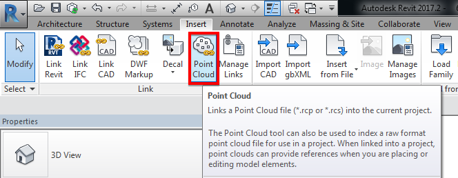
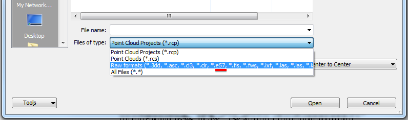
Link the “Point Cloud” under “Insert” tab and “Link” menu ribbon options. I found out that you can link the e57 file format. See image below for file type options supported.
Now, I’ll try to import the e57 file format using “Auto – Origin to Origin” positioning and see what will happen.
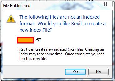
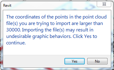
I’ve got that warning message and from that, it leaves me no choice than to click “Yes” for it to work. So, I clicked “Yes” and this window popped up:
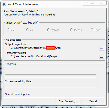
Continue the process by clicking the “Start Indexing” button then you can grab a coffee as this will take a while depending on the size of your e57 file. In my case, the file size is around 30GB, so enormous!
While the file indexing is progressing, you can do other stuff to keep you busy.
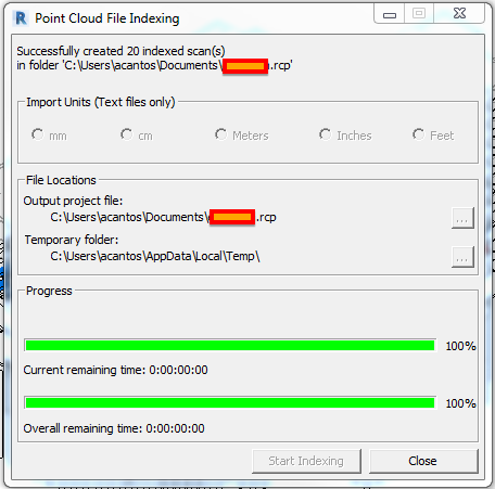
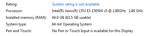
Now the process is completed. Unfortunately, I lost track of the time it took to process the almost 30GB e57 file. However, I reckoned, it took 2.5 hours using my Lenovo ThinkPad P70 laptop. Additional specifications are shown below.
As advised previously, we can link the new file once completed, which is now in the format of .rcp. A .rcp format file is a project file that groups together multiple .rcs scan files. The result of indexing a raw format file is a .rcp file and one or more .rcs files.
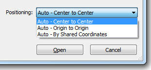
For now, I’ll use “Auto – Origin to Origin” as positioning.
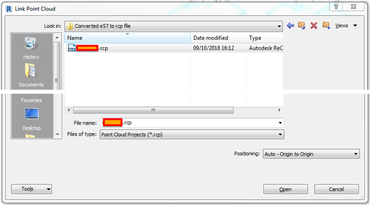
Click “Open” and it gave me a warning.
I hit “No” and try again but, this time using “Auto – Center to Center” positioning, then click “Open”.
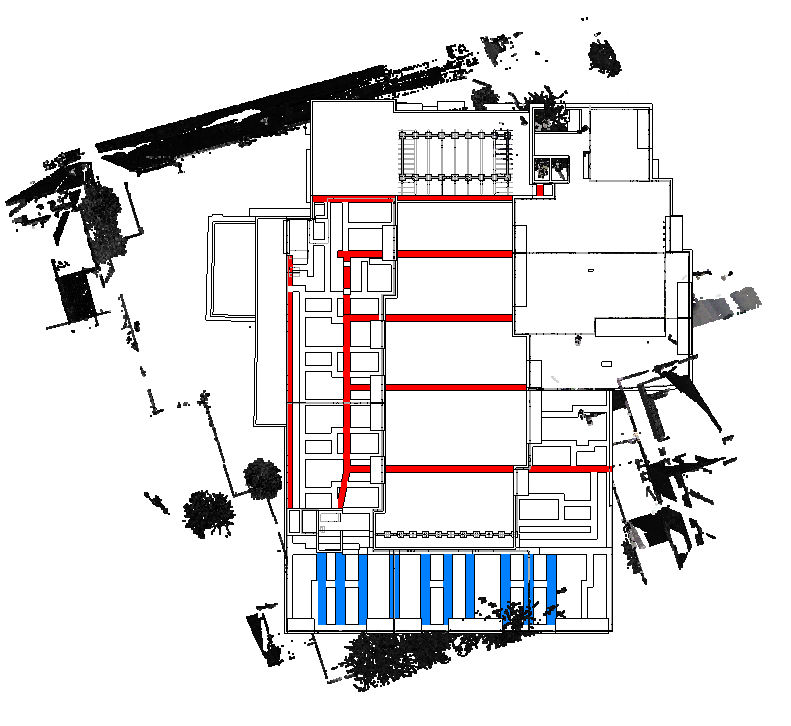
I have the same warning as the one above. This time instead of clicking “No”, I hit the “Yes” button and the result…..the point cloud is rotated.
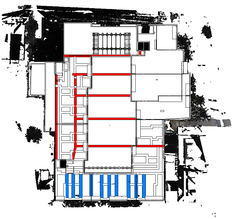
I tried again but, this time using the last positioning option, which is “Auto – By Shared Coordinates”, then click “Open”.
Again, same warning message, hit “Yes” and voila! it landed on the area around the building to be constructed.
I welcome your comments, questions, corrections and additional information relating to this article. If you know a better way, please leave your comment, by all means, let me know. Thanks.
Have a great day.
Cheers.
Allan Cantos EngTech MICE
BSc Civil Engineering / Principal Structural Technician